
Yorkshire Wolds Way Part 1
The first leg of the Yorkshire Classic hike.
For those who don’t know the Yorkshire Wolds Way is a National Trails which runs for around 79 miles, starting at Hessle Foreshore and finishing up on the impressive Filey Brigg. It winds its way through some of the most picturesque parts of East Yorkshire, many of which you may not ever happen upon unless you were on the trail. There’s a couple of ways to tackle the hike, either in stages or doing the full lot in one go over a number of days (usually around 5 days). Having only the one day free I opted just to get the first stage done and return to do the rest another time. If you look online there’s varying information on where stage one finishes, it’s usually either South Cave or North Newbald. I guess it depends how much time you have and how your legs are feeling, both however are great pickup/drop off points if your doing it in stages. My plan was to try and push on to North Newbald as it means the rest of the stages are more manageable. The definitive start to the Wolds Way is a rock structure placed down on Hessle Foreshore ( near the ice cream van for those who know the area). After getting dropped off on the main road I trundled down to get a picture on the start line only to find a load of construction work going on and preventing me from doing so, so far so bad! Although, since I like to be thorough in my descriptions and guidance in this blog ,I feel like a picture of the start is fairly fundamental for others wanting to follow suit, so when I’m next in the area I’ll grab one….promise.


I soon forgot the disappointing start as I worked my way along the edge of the river and under the mighty Humber Bridge. It was a crisp frosty morning which couldn’t be better for hiking as it can get pretty warm carrying a big rucksack full of food, drink and camera equipment. Unfortunately I didn’t have time to take a detour through the picturesque reclaimed quarry known locally as ‘Little Switzerland’ which sits next to Hessle Foreshore, its worth a wander through if you’re in the area. It used to be an old chalk quarry many years ago but since the work stopped nature has taken it back over. The trail hugs the River Humber for a couple of miles before arriving at North Ferriby. There is a shop in the village centre if you need a supply stop at all, although it is a mile or so detour. The trail drops down onto the shorefront here where depending on the tide you’ll find your self either strolling along the pebble and mud or leaping from on large rock to another to avoid the water. Either way you’ll end up at the aptly named Long Plantation, its the first large wooded area you encounter on the way and is a nice contrast in scenery from walking along the river. Although it doesn’t quite feel like being out in the proper ‘sticks’ at this point as many houses have their gardens backing onto the woodland so it shatters the illusion a tad. For me the real ‘wilderness’ starts about half an hour later just after you cross the busy A63, there is a Wolds Way sign with ‘Welton 1/2 miles’ written on, from here you enter a great bit of native woodland and leave the busy road and noise behind you. I feel this is where I properly settled into the hike and (without sounding too much like a hippy) be calm and alone with my thoughts while soaking in the nature around me. There’s a good bit of incline here before reaching the scout hut at the top of the hill, definitely gets the lungs going. From here you drop down to the cement works before another ascent brings you into Welton village.


Welton Dale lies just on the outskirts of the village and I’d rate it in the top 3 beauty spots on the first part of the YWW. I’ve been coming here for walks for many yeas, the recent introduction of a fence stopping you from accessing the whole dale ( I think its to keep cattle separate from walkers) is slightly annoying . It used to be nice to climb up and walk along the edge, but it’s still almost as good walking along the bottom. The lovely green valley has a great sloping side which leads up to thick dark woodland making you feel like you’re getting swallowed by the landscape as you meander along the valley floor.


After leaving Welton Dale there isn’t too much to write home about until you reach the next village of Brantingham. The trail drops you out near the church on the back road just outside the main village. With it being so quiet and peaceful it was the perfect spot for dinner ( another one of my top 3 scenic spots on the first leg). Finding a bench in the church grounds I snaffled my food before speaking to a local older couple who had done the trail many years ago. They spoke of how the scenery just gets better and better the further on you get and laughed when I spoke of how I’d like to do the rest of it in one push, spending the nights wild camping in a hammock ( wait and see!).
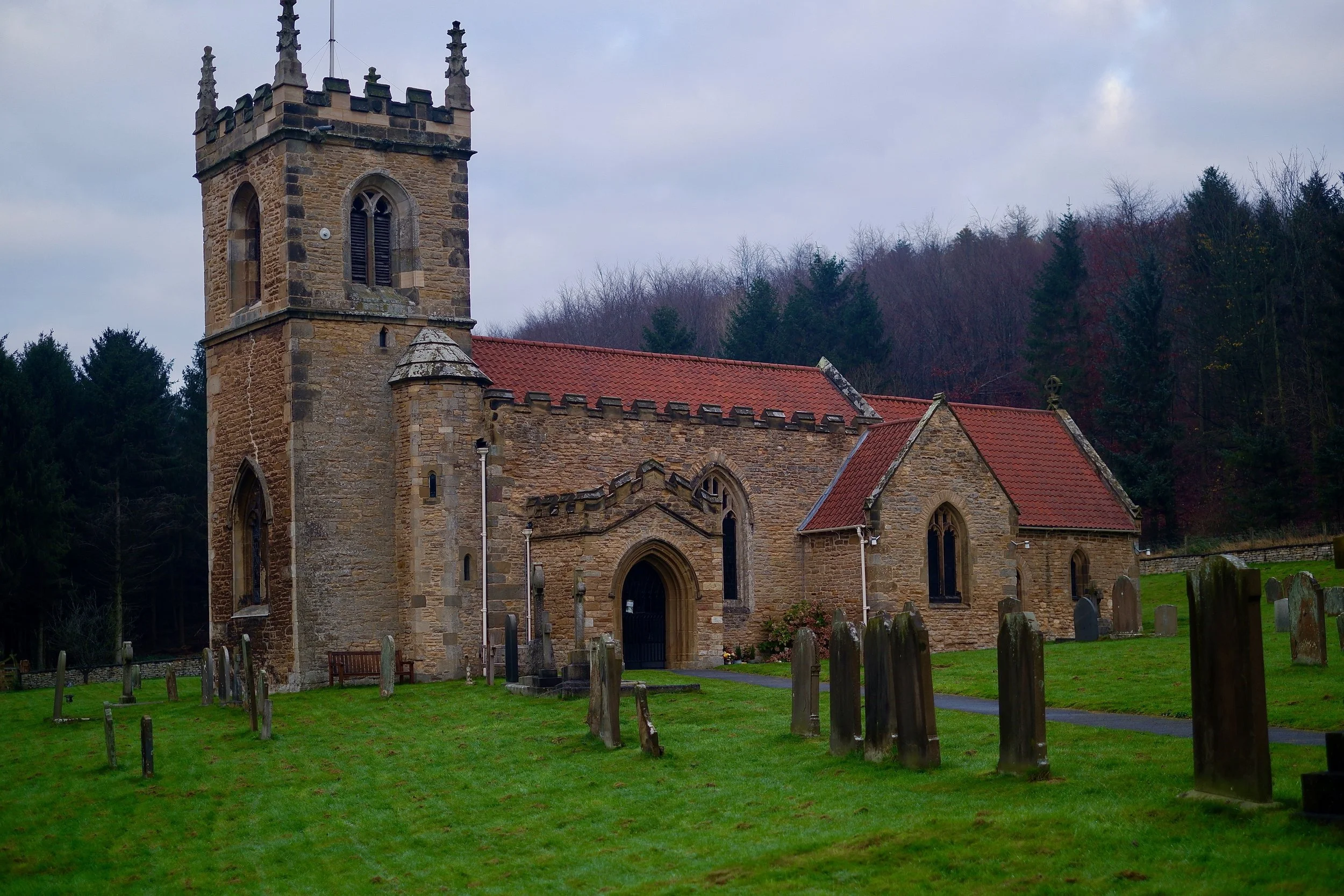


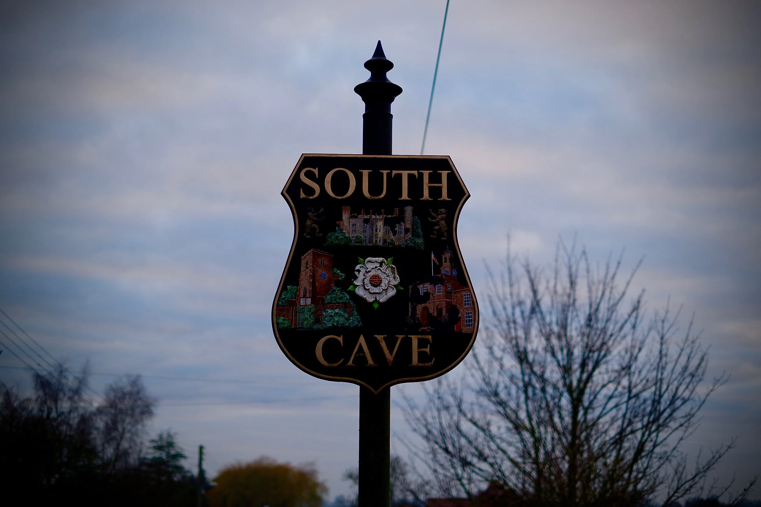
After leaving Brantingham the trail gets back into some thick woodland before winding its way up to near the small hidden airfield of Mt Airy. Not many people would believe you if you told them it was up there, but it sure is, wind socks and everything. Dropping down from here is the large village of South Cave, as with most of the villages on the Wolds Way the actual trail only kisses the boundary before vanishing back into the fields and woodland, just how we like it.


Little Wold Plantation is the name of the next great woodland on the path. I’m proud to say my grandparents who live in South Cave contributed along with many other local people to the buying of the woodland in this area to protect it from future development. We’d often be brought up here to play when I was younger and would have a great time messing in the wood and sneaking into the nearby quarry for a look. There was also stories of a secret bunker which used to be hidden in the woods which during WW2 would be used as a base to carry out sabotage strikes if the Germans invaded. Although the bunker had never been found there is a large crater where one could have been. Descending from here you eventually reach what I know as Weedley Springs. Im not sure if that’s the proper name or just what my grandparents called it, they had strange names for another local woodland too which went by the name of the ‘dingley dell’. I’ve had strange looks off people before when mentioning these paces which is why I’m sceptical. Weedley Springs is a really unique place. Not only is the landscape quite dramatic with a great rolling valley filled in with a dense forest, but because it’s where natural springs cause crystal clear water to bubble out of the chalk and form small pools before flowing off towards the Drewton Estate. The water is clean enough to drink ( I’ve drank it many times), great for refilling water bottles on big hikes.


The springs run alongside of the old railway line which is unfortunately now private land.This was the course of the former Hull to Barnsley line which was used to transport coal from the mines of South Yorkshire to the docks at Hull. This section of the line was closed in the 1950s. However, It’s usually quiet enough to drop down off the trail and get a sneaky look at the magnificent tunnel and bridge which can be found a mile or so from the springs. Just watch for vandal grease if you get right up to the boards which block the tunnel, you wont get that off your clothes!


Back on the main path you follow the valley up and out of the woods, occasionally passing these curious stones which I’m guessing were used as boundary markers between the Drewton and the next estate.

Theres a couple of other interesting structures on this part of the walk too. The first is the fairly easily accessible Trig Point marking the highest point in the area. The concrete plinth is a short walk into a nearby field so be quick with your visit and don’t damage any crops growing.
The second point of interest is the High Hunsley Beacon which lies just over the fast moving B1230 ( be careful when crossing). The beacon was erected in 2002 to celebrate the Queens Jubilee.


A little further down the way on just outside North Newbald you encounter the first of the many dry valleys the Wolds Way has to offer. These valleys are a result of the underlying permeable chalk allowing any water do disappear into the ground instead of running along the surface.
The valley was eerily quiet when I passed through as it was getting late, the sun had set and there wasn’t a soul to be seen (apart from a barn owl that swooped up and down the valley sides looking for a snack). Leaving Swin Dale at the edge of the valley the last 300m is an uphill slog past a farm to a small car park where I was relived to see my ride already there waiting for me after, time for a sit down.


